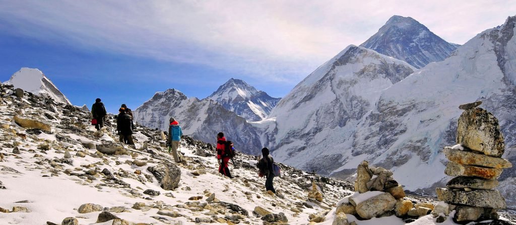
Mt. Everest is the highest point on earth. The height of Mt. Everest was measured as Peak XV in 1852 was 29,002 ft (8,840 m) above sea level. When its height was measured again in 1954, it was recorded as 29028 ft (8,848m). Recently, in 1999, when it was again measured with modern equipment & satellite ( National Geographical Society, November 1999) its height was recorded as 29,035 ft (8850m) above sea level.
Mt. Everest straddles the international boundary between Nepal & Tibet Autonomous Region (TAR). The north slope of Everest falls within TAR & south slop with in Nepal. It was for the1st time a Swiss Expedition to MT. Everest was organised in 1952. It included the Swiss Guide Raymond Lambert & Tenzing Norgay Sherpa. This Expedition contributed in reconnaissance survey of southern Everest area & particularly the most accessible South Col route to Mt. Everest. On May 29, 1953 the British Expedition Team under the leadership of Lord John Hurt, Late Tenzing Norgay Sherpa (Nepali) & Sir Edmund Hillary (New Zealand) made a sensational historical event, ascending the peak. They went through Khumbu Glacier and continued their ascent to summit via the South East Range.
This highest mountain lies at position of: Latitude: 27 °59’17’’ & Longitude 86°55’31’’
1st Nepali Climber: Late Mr. Tenzing Norgay Sherpa
Normal Ascent Route: South East Range
Caravan Route: Ktm-Lukla-Namche-Pheriche-BC
Mount Everest, the greatest challenge, is more than the famous mountain on earth; it has unique beauty, mystery and mood. Everest expeditions in Himalayas is one of the world\’s most difficult physical challenges. No doubt, climbing Mt. Everest leaves the sense of most adventurous person on the planet. Everest\’s local names give you a sense of how the mountain commands respect from all who see her. The Nepali name, Sagarmatha, means \”head touching the sky\” and in Sherpa, Chomolungma, meaning \”Mother Goddess of the world\”.The toppers feel proud to climb Mt. Everest 29028ft (8,848m) and are adventurous like Sir Edmond Hillary and Tenzing Norgay Sherpa who first climbed the summit for the first time in May 29, 1953. Their effort brought Khumbu glacier as a base camp of Mt. Everest. Most of the tourists need Sherpa’s to climb but some of them do not need the guide and climb themselves. Most of the climbers carry internet, satellite telephone, medical doctor, and modern requirement.
After crossing crevasses, seracs and ice blocks we should face to the way up having chunks of ice as large as our houses. Ropes and aluminum ladders should be used to climb the first camp 6,400m.
Camp1: 20,000ft (6,400m): Camp1 situated on the flat area of endless crevasses and mountain walls. Because of the Sun’s reflection we get warm and heating ambience. Murmuring and crackling sound of crevasses beneath the tent will wake up us and it’s a natural sound from where we have to walk to reach camp2.
Camp2: 2,21000ft (6,750m) :The 2100m footed mount is located on the foot of Mt. Lhotse through we have to go ahead. Weather here is good but sometime heavy wind destroys our tents where we rest. After climbing these places we proceed to camp no3.
Camp3: 3,22300ft (7100m):It is located to just to Mt. Lhotse wall. After climbing the four thousand meter Lhotse wall by using fixed rope and with prior acclimatization. This way heads to camp 4 for Mt. Everest. from there short snowfields the route moves ahead up to Geneva spur to the east before finishing the flats of the south col. In camp3 the amount of oxygen is less than normal so, climber should be provided oxygen when needed.
Camp4:4, 26000ft(8400m):Now we are just 500m for the summit in the camp no.4 situated at 26000ft. but its path is somehow dangerous. The normal way via the narrow south East Ridge and it precedes the south summit 28710ft. This place is final but dangerous part of climbing because this place is besieged by ferocious and violent winds.


